LiDAR gives utilities foresight to predict risks, manage vegetation, and prevent wildfires before they start.
By Prasad Kamisetti, Associate Director of Utilities, Techwave
In the utility space, safety has always been the standard. It is not a nice-to-have, nor a goal to aim for, but the foundation on which every decision rests. Each day, electrical distribution companies manage networks that must withstand both regular demand and unpredictable conditions. That part has not changed. What has changed is the intensity of those conditions, with wildfire risk now at the centre of it.
Fires once felt like seasonal threats. Today, they carry the weight of constant pressure. They are moving faster, burning hotter, and showing up in places no one expected. For utilities responsible for lines, substations, and infrastructure spread across vulnerable landscapes, this shift means that the way they plan, monitor, and act cannot remain the same. For us, as supporting partners, it means bringing in tools and insights that help them make that transition with foresight, rather than after the fact. For many, wildfire prevention with LiDAR has become a critical part of this strategy.
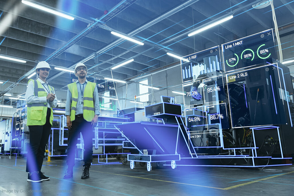
That shift started, at least for us, when we brought LiDAR and remote sensing into our toolkit. Leveraging remote sensing for grid safety, utilities can move from reactive to proactive risk management by anticipating hazards before they manifest.
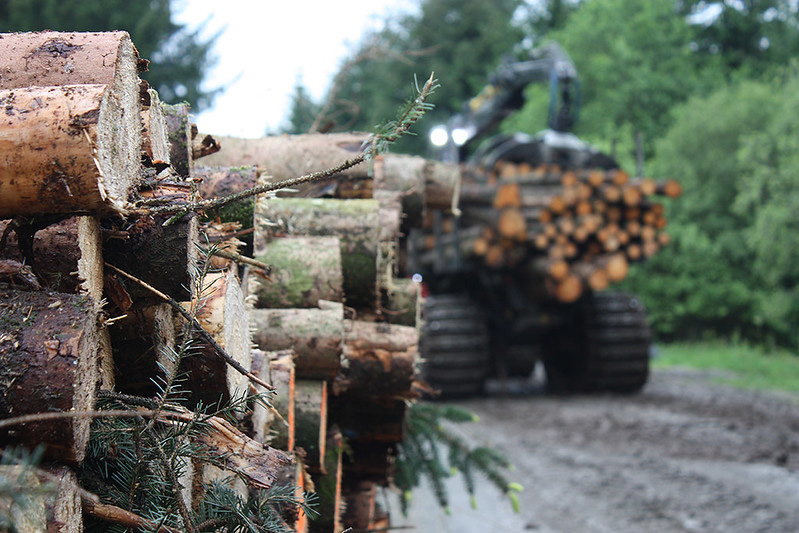
For years, utility vegetation management followed a predictable pattern. Crews were dispatched, line sections were inspected, and any identified risks were documented and mitigated. These inspections happened on cycles. Quarterly. Semi-annually. Depending on geography and budget. It was a system built on discipline, local knowledge, and a lot of manual effort.
But trees do not grow in cycles. Climate does not wait for audits. And we learned, sometimes the hard way, that fixed routines do not catch dynamic problems.
A limb that is fine one month could be a fire starter the next. And in some areas, we would only discover issues after a near miss or a regulatory inspection. That is when it became clear. We were not doing anything wrong. We just did not have enough visibility. Or speed. Or foresight.
LiDAR changed the game because it gave us eyes where we did not have them. And it gave us clarity that did not fade.
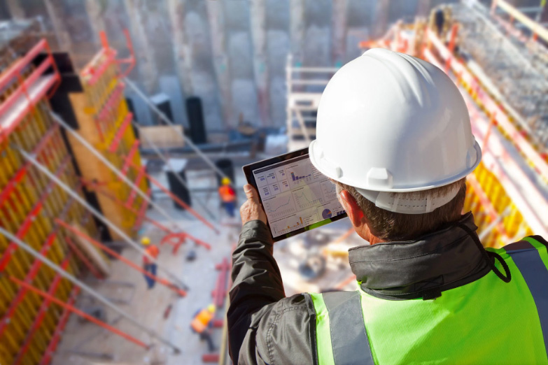
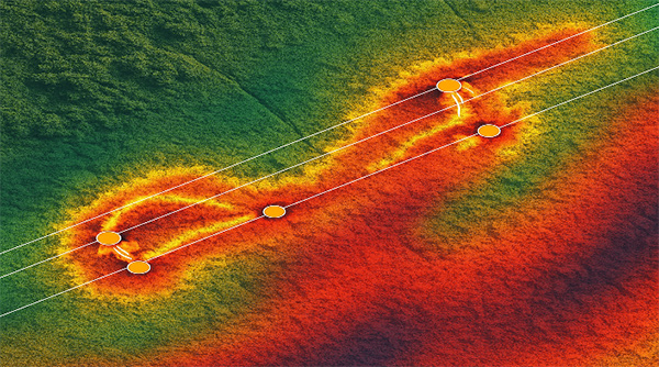
By capturing thousands of laser pulses per second and mapping their return times, LiDAR lets us build a three-dimensional model of the landscape. That includes every tree, pole, conductor, and slope. It turns inspection into a digital layer that we can zoom in on and learn from.
When combined with GIS and our existing grid data, LiDAR creates a comprehensive model of risk that we now consider. A digital version of the field that is not static. It is alive. It evolves with every new scan and gets smarter over time. With routine remote sensing for grid safety, utilities benefit from a living digital model that strengthens their ability to prevent disasters.
Now we do not just inspect for what is visible. We anticipate what is likely. And that is a massive shift.
Here is a real example. We collaborated with a utility partner in Western Australia that had a network operating in some of the country’s most wildfire-prone terrain. Their teams were doing all the right things. Scheduled inspections. Routine trimming. Visual surveys. But their visibility was limited by scale, and the landscape was working against them. With aerial LiDAR scans and analytics support, we helped them map their full grid, identify vegetation risks based on proximity and growth patterns, and prioritize clearance. No assumptions. Just data. Within a few weeks, they had a heatmap of real encroachments, not theoretical ones. They reduced their hazard response time, focused their maintenance crews, and avoided overspending on areas that were not urgent. That experience taught us something. Even a well-managed network can be blind to wildfire risk unless you are looking from above with the right tools—such as LiDAR and robust utility vegetation management.
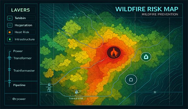
What often gets missed in the LiDAR conversation is that it is not just about vegetation. We are using the same data to track pole tilt, erosion around foundations, and line sag in high heat zones. We are now building composite risk models that pull from terrain, structural health, vegetation density, and even wind patterns. That gives us a way to make smarter choices from deciding where to trim to when to send out a crew and where to harden infrastructure before fire season begins. In short, LiDAR helped us stop treating symptoms and start planning around root causes, redefining utility vegetation management as a high-tech, data-driven discipline.
None of these matters if leadership still sees wildfire prevention as a compliance task. That has been one of the hardest conversations to shift. Helping everyone transition from checklists to strategy. But once people see what data like this can do, how it reduces surprises, protects teams, and prevents damage, the shift starts to happen on its own. It is no longer about catching up to risk. It is about getting ahead of it. And in our case, that cultural change meant aligning our entire approach around foresight. We stopped asking if we covered enough ground this cycle and started asking if we know where the next threat is likely to come from. That is the core advantage of embracing remote sensing for grid safety and leveraging LiDAR for wildfire prevention.
That one question changed everything.
If you are in this space, managing utility operations in a high-risk environment, here is what I have come to believe. Wildfire mitigation is not a one-time investment. It is not a seasonal project. It is an ongoing responsibility. Technologies like LiDAR and remote sensing will not solve everything on their own. However, they will provide your teams with clarity. They will eliminate the guesswork from your inspection programs. And they will help you build a network that is not just reliable but truly ready. We cannot control the heatwaves, wind gusts, or ignition sources that we do not see coming. But we can control how well we understand our assets. How quickly we act. And how much risk do we allow to go unmeasured?
Right now, that is the difference between preparedness and exposure.
We have reached a point where waiting is no longer an option. The fire seasons are longer. The margins are thinner. The expectations are higher. And the good news is, with the right insight and leadership, we are no longer stuck in the past. Utility vegetation management, combined with wildfire prevention, utilizes LiDAR and remote sensing to ensure grid safety, positioning us to meet these expectations. We are finally stepping into foresight.

About the Author:
Prasad Kamisetti is Associate Director at Techwave, where he leads geospatial programs across utilities, public systems, and telecom networks. With more than two decades of experience in geospatial intelligence, he specializes in building frameworks that power smart infrastructure, utility modernization, and digital transformation. At Techwave, he works with business and technology leaders to integrate advanced geospatial technologies into enterprise operations, improving service reliability, infrastructure planning, and digital adoption.
Prasad began his career in photogrammetry and satellite imaging and later held senior leadership roles at Cyient, driving global geospatial transformation programs. He holds a postgraduate degree in Geography and Remote Sensing and management education from the Symbiosis Institute of Management Studies.

Industry in Transition: The Forces Reshaping Manufacturing
As manufacturers offer more customization than ever before, managing product complexity has become a critical challenge. Tune in with Dan Joe Barry, Vice President of Product Marketing at Configit, who explores how companies are tackling the growing number of product configurations across engineering, sales, manufacturing, and service. He explains how Configuration Lifecycle Management (CLM) helps organizations maintain a single source of truth for configuration data. The result: fewer errors, faster quoting, and the ability to deliver customized products at scale.
Get In Touch
Google news and SEO compliant, Industry Today’s state-of-the-art digital media platform offers bespoke media campaigns that target key decision makers and buyers to achieve your marketing and promotional goals.
![]()
Contribute
Showcase your brand and promote your business to our highly targeted audience. We offer detailed Google Analytics with measurable ROI to assure success. Submit your content for review by our Editorial team who will contact you to discuss the project further.
About Us
Reach Your Targeted Audience and Grow Your Business. Learn more About Industry Today.
Contact Us

© 2026 Industry today. All Rights reserved.