The move allows for solutions to address the evolving needs of urban planning, environmental science and infrastructure development clients.
JERSEY CITY, N.J. – Dresdner Robin, a prominent land-use consultancy firm specializing in urban and suburban design and development, has expanded its services to now include resiliency planning and geospatial analysis and mapping, utilizing geographic information systems (GIS). This strategic move reflects the company’s commitment to providing comprehensive solutions that address the evolving needs of clients in the fields of urban planning, environmental science and infrastructure development.
“Our further expansion into geospatial analysis and mapping, along with resiliency planning services is a testament to our commitment to innovation and client-centric solutions,” said Tony Ianuale, COO and CFO of Dresdner Robin. “These enhanced services will enable our clients to navigate complex challenges and achieve their project goals with greater precision.”
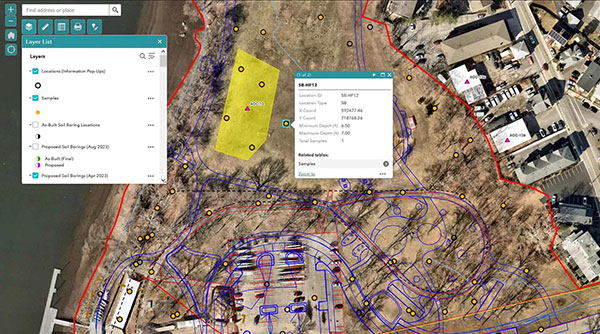
GIS is a computer system for capturing, storing, checking and displaying data related to positions on Earth’s surface. It helps users understand patterns, relationships and geographic context and is a crucial part of spatial data infrastructure. The firm’s geospatial analysis and mapping services will support projects ranging from indoor racetracks to mixed-used developments to stormwater drainage. Specific services will include contaminant and groundwater modeling, environmental assessment, 2D and 3D modeling and insight for recreational space remediation.
This offering to clients that can help them efficiently gather data, analyze that data and visualize it for their specific purpose. Geospatial analysis and mapping services can bridge the gap between the client, subject matter experts, and the data itself by answering spatial questions and making such data accessible and understandable to everyone involved in a project.
“GIS technology plays a pivotal role in shaping the future of urban development and environmental planning,” said Frankie Albin, GIS manager at Dresdner Robin. “We’ve seen success in projects where our team had already implemented GIS and are thrilled to expand the service offerings to all clients, regardless of the project. Our team is dedicated to harnessing the power of GIS to create resilient and sustainable solutions for our clients.”
Alongside geospatial analysis and mapping, the company is also offering enhanced resiliency planning services to assist communities in being proactive about coping with threats related to extreme weather and other climate change patterns. This type of planning includes identifying general risk, understanding unique vulnerabilities given a community’s social and geophysical qualities, and developing system-based solutions that will allow a community to optimize the way they plan, invest in and implement resiliency measures in years to come.
“As we embark on the expansion into resiliency planning at Dresdner Robin, I firmly believe that resilience is an integral part of every service we provide,” said Mallory Clark, senior planner at Dresdner Robin who will lead these efforts. “We’re not just shaping cities; we’re helping clients build visions and plans embedded in longevity and adaptability for the challenges ahead. Embracing the need for flexibility and endurance through future growth in all facets of the built environment, I see this as a pivotal moment for our company and the communities and clients we serve.”
Dresdner Robin’s expanded services in resiliency planning include providing technical assistance and professional planning services for master plan compliance, hazard vulnerability assessments, and design development of resiliency infrastructure projects in communities throughout the state.
2021 updates to the NJ Municipal Land Use Law (40:55D-28 & 40:55D-28.1) require communities to incorporate a climate-change-related hazard vulnerability assessment as part of their Land Use Element of the Master Plan. This new service is aimed to support those requirements by helping clients identify potential hazards and threats, and then establish adaptation, mitigation and recovery plans.
The team of experts leading resiliency planning services will include the planning services and strategic development group with support from civil engineering, landscape architecture and environmental teams.
About Dresdner Robin
Dresdner Robin is a leading land-use consultancy with a specialty in urban and suburban design and development and brownfield redevelopment covering the New York, New Jersey, and Philadelphia metro markets. The full-service firm provides creative solutions that emphasize service, client satisfaction and technological innovation, with specialties in site/civil engineering, land surveying, environmental services, planning, surveying and landscape architecture in the revival of urban landscapes. For more information about Dresdner Robin, visit https://www.dresdnerrobin.com/.

Forging the Next 250 Years: Powering the Next Era of American Manufacturing
As manufacturers offer more customization than ever before, managing product complexity has become a critical challenge. Tune in with Dan Joe Barry, Vice President of Product Marketing at Configit, who explores how companies are tackling the growing number of product configurations across engineering, sales, manufacturing, and service. He explains how Configuration Lifecycle Management (CLM) helps organizations maintain a single source of truth for configuration data. The result: fewer errors, faster quoting, and the ability to deliver customized products at scale.
Get In Touch
Google news and SEO compliant, Industry Today’s state-of-the-art digital media platform offers bespoke media campaigns that target key decision makers and buyers to achieve your marketing and promotional goals.
![]()
Contribute
Showcase your brand and promote your business to our highly targeted audience. We offer detailed Google Analytics with measurable ROI to assure success. Submit your content for review by our Editorial team who will contact you to discuss the project further.
About Us
Reach Your Targeted Audience and Grow Your Business. Learn more About Industry Today.
Contact Us

© 2026 Industry today. All Rights reserved.